
On Tuesday, April 6th we took a 30 minute drive to the boarder to head to Guatemala . Once we got through customs with two more stamps in our passports, we were on our way to Tikal. It was about another hour and half drive until we reached the Tikal National Park.
 . Once we got through customs with two more stamps in our passports, we were on our way to Tikal. It was about another hour and half drive until we reached the Tikal National Park.
Tikal is one of the largest ruins in the world which covers over 8 miles of land. It use to be one of 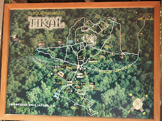 the most powerful Mayan kingdoms. Today only 20% of the ruins have been excavated by a university from PA (15%) and the Guatemalan government (5%). To full enjoy this site though it would take days just to be able to see everything. In the two hours we were there, we got to see about 6 of the main temples, but there was still so much more to see.
 the most powerful Mayan kingdoms. Today only 20% of the ruins have been excavated by a university from PA (15%) and the Guatemalan government (5%). To full enjoy this site though it would take days just to be able to see everything. In the two hours we were there, we got to see about 6 of the main temples, but there was still so much more to see.
 The first place we stopped was Temple Q. There was a few temples that looked like this one which were only used for ceremonies. After that we got to climb Temple IV, which is the tallest temple standing at 210 feet tall. We could not climb up the actual temple itself, which was probably a good thing because of safety. But, there was a staircase that was built up the side of the temple for people to climb, and then sit on the side of the temple. Once on top of Temple IV, we were above all the trees, and we could see other temples as well. In the picture are Temple III, II, and I.
 like this one which were only used for ceremonies. After that we got to climb Temple IV, which is the tallest temple standing at 210 feet tall. We could not climb up the actual temple itself, which was probably a good thing because of safety. But, there was a staircase that was built up the side of the temple for people to climb, and then sit on the side of the temple. Once on top of Temple IV, we were above all the trees, and we could see other temples as well. In the picture are Temple III, II, and I.
 After the hike back down, we headed to the lost world. It consisted of four more temples. Our next adventure was the Great Plaza to go see Temple I and II. We were allowed to climb to the top of Temple II, which is shown in the picture on top. Temple I is known as the Great Jaguar, and is the burial spot for Ah Cacao. Ah Cacao built Temple II as well. This whole adventure took us over two hours, and we did not even get to see all the ruins.

On Thursday, Aprtil 8th some of us went to visit our next Mayan ruin, Xunantunich. This ruin  was just a short bus ride outside of San Ignacio, Belize. Xunantunich was the first site to be opened up in Belize to the public. Once across the short ferry ride and a nice mile hike up the hill, you reach the main
  ceremonial quarter of Xunantuich.
 was just a short bus ride outside of San Ignacio, Belize. Xunantunich was the first site to be opened up in Belize to the public. Once across the short ferry ride and a nice mile hike up the hill, you reach the main
  ceremonial quarter of Xunantuich.
The tallest pyramid is called El Castillo which is shown in the picture. El Castillo is the tallest at Xunantunich at 130 feet tall. On top of El Castillo you have a 360 degree of the surrounding land. Not only will you see part of the Belize jungle and river valleys, but you will also see the boarder between Belize and Guatemala. Right behind me in the picture is the boarder. The adventure to the Mayan ruins was an amazing experience. One in which I will never forget.


No comments:
Post a Comment